
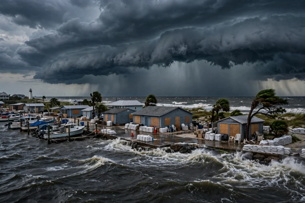
Hurricane Isaias Strengthens Toward Gulf Coast Landfall
Hurricane Isaias is strengthening over the warm waters of the Gulf and moving toward the northern Gulf Coast, where forecasters expect landfall late Friday. The storm became the first Atlantic hurricane of the 2026 season late Wednesday, ending an unusually long wait for the basin’s first hurricane, according to reporting by USA TODAY and EarthSky.
The National Hurricane Center said Isaias had maximum sustained winds of about 80 mph early Thursday, after reaching hurricane strength late Wednesday with winds near 75 mph. The center of the storm was located several hundred miles south-southwest of the mouth of the Mississippi River on Thursday morning, moving toward the coast as conditions allowed further strengthening.
Hurricane Isaias landfall forecast for Friday evening
Forecasters at the National Hurricane Center expect Isaias to approach the northern Gulf Coast on Friday and make landfall Friday evening. The forecast track issued early Thursday placed a possible landfall zone along roughly 130 miles of coastline between Gautier, Mississippi, and Miramar Beach, Florida, with a likely center point near Orange Beach, Alabama, according to USA TODAY’s review of the hurricane center forecast.
Officials cautioned that the exact landfall point could still shift outside the forecast cone. Small changes in track will matter for which communities see the strongest winds and the highest water, especially around bays and inlets where storm surge can build quickly.
- Expected landfall window: Friday evening into early Saturday
- Forecast zone: coastal Mississippi, southern Alabama and the Florida Panhandle
- Possible strength near landfall: strong Category 2 in some forecasts, with winds that could approach 110 mph before weakening influences increase
- Main hazards: life-threatening storm surge, hurricane-force winds, flooding rain and isolated tornadoes
A record-late first hurricane for the Atlantic
Isaias is notable not only for where it is headed, but for when it formed. Hurricane specialists cited by USA TODAY described Isaias as the latest first hurricane of an Atlantic season by a wide margin in reliable records. Its development also leaves intact a much older benchmark from 1914, the last known Atlantic season with no hurricanes, according to Phil Klotzbach of Colorado State University, as reported by USA TODAY.
The slow Atlantic season contrasts with a very active Pacific season shaped by record warm waters, according to forecasters cited in national reporting. That contrast has been a recurring theme of the 2026 season, with Atlantic systems repeatedly struggling against dry air and wind shear before Isaias finally organized in the Gulf.
Why rapid strengthening is a concern
Forecasters warned that Isaias is moving over Gulf waters in the mid-80s, warm enough to support quick strengthening. AccuWeather meteorologists cited in regional reporting said rapid intensification remains possible as the storm approaches the coast. At the same time, increasing wind shear near landfall may limit how strong Isaias can become, a tug-of-war that forecasters will be watching through Friday.
Preparations along the Gulf Coast
Airports, utilities and energy operators began adjusting operations on Thursday. The Destin-Fort Walton Beach Airport in Florida said it would end operations Thursday night until further notice, according to regional reporting, while airports in Pensacola, Tampa and Sarasota monitored the storm and urged travelers to check with airlines.
Alabama Power prepared crews and outage-reporting tools ahead of expected power disruptions, according to Alabama news outlets. In the offshore Gulf, Barron’s reported that Shell and Chevron were pulling workers from platforms in advance of the storm, a standard safety step that can also temporarily reduce production.
Florida had already declared a state of emergency covering 25 North Florida counties earlier in the week, according to reporting in the USA TODAY Network, as watches were posted along hundreds of miles of coastline.
What residents should expect after landfall
Once inland, Isaias is expected to weaken quickly while still producing heavy rain. The hurricane center forecast described the system curving northward after landfall, bringing the remnant low toward western Tennessee and Kentucky by Sunday as a post-tropical depression, according to USA TODAY. Communities well away from the coast could still see flooding rain, gusty winds and power outages through the weekend.
Emergency officials across Mississippi, Alabama and Florida urged residents in the forecast zone to finish preparations soon, monitor updates from the National Hurricane Center and local authorities, and be ready to follow evacuation guidance from county emergency managers. Forecasters stressed that impacts will extend well beyond the exact landfall point, particularly on the eastern side of the storm where onshore winds push water toward the coast.
Radiosea will continue tracking Hurricane Isaias as new advisories are issued. Readers along the Gulf Coast should rely on the National Hurricane Center and their local National Weather Service office for the latest official forecasts, watches and warnings.
Pingback: Hurricane Isaias Leaves Hundreds of Thousands Without Power
Pingback: Oil Prices Surge Above $105 as Iran Tensions Escalate - RadioSea