Florida Braces for Dangerous Surf and Rip Currents Weekend
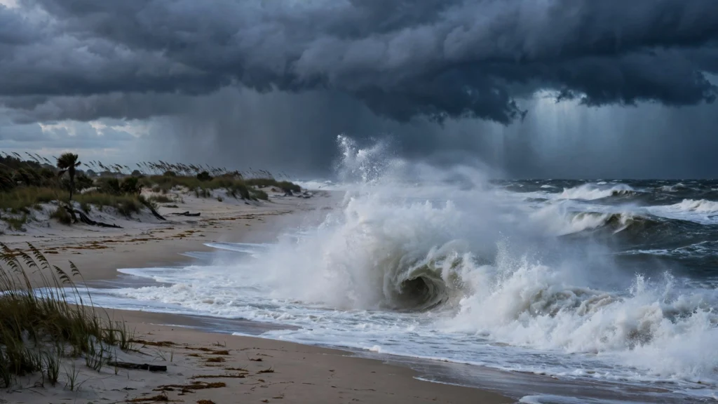
Florida dangerous surf rip currents warnings will dominate the state’s east coast this weekend, as large breaking waves, high tides, and river flooding combine to make conditions treacherous along Atlantic beaches.
Building seas will bring large breaking waves and dangerous rip currents to beaches from South Carolina to South Florida beginning Friday, October 23, according to AccuWeather. A high rip current risk is in effect for much of Florida’s coast through Monday evening, the National Weather Service said, and swimmers are advised to watch for danger flags and swim near a lifeguard.
“This will not be a great weekend along Florida’s east coast,” said Megan Tollefsen, meteorologist with the National Weather Service in Melbourne, in an interview with the Naples Daily News on October 22.
Ten-foot breakers and “pretty nasty” beaches
Expect rough conditions at the beaches, with continued wave heights of five to six feet and breaking waves of 10 to 12 feet, Tollefsen said. Dangerous waves, increasing winds, beach erosion, and dangerous rip currents — along with astronomical tides over the weekend — will make conditions “pretty nasty,” she added.
The worsening beach conditions can be attributed to a high-pressure system forecast to develop and strengthen over the eastern U.S. and its interaction with a low-pressure system that could develop over the Bahamas, according to AccuWeather.
A small craft advisory is in effect for the coastlines of the entire state through Saturday evening, and officials in Central Florida are urging beachgoers to stay out of the water. Gusts at the coast could reach 40–45 mph this weekend.
Coastal flooding through the weekend
A coastal flood advisory is in effect for most of Florida’s east coast until Saturday for the north and central parts of the state and Sunday morning in the south, the NWS said. A coastal flood watch will be in effect from late Saturday night through late Sunday night.
NWS Jacksonville expects the peak tidal flooding on Sunday and Monday along Atlantic, Intracoastal, and St. Johns River locations, with strengthening high pressure to the north and a coastal trough offshore tightening the pressure gradient. Repeated shower bands may produce locally heavy rain along the northeast Florida coast Saturday afternoon and evening, potentially overlapping the evening high tide.
NWS Jacksonville issued a Coastal Flood Advisory at 12:46 a.m. Friday for coastal Duval, Flagler, and St. Johns counties, warning that numerous roads may be closed and low-lying property — including homes, businesses, and some critical infrastructure — may be inundated.
St. Johns River rising
The St. Johns River near Astor has risen into moderate flood stage, overflowing into yards, blocking roads, and submerging local docks, the NWS said. Flooding is expected to continue through the weekend with the potential to reach major flood stage next week.
Officials advise residents in flood-prone areas to take protective action, allow extra travel time, and never drive around barricades or through water of unknown depth.
What happened to Josephine?
Subtropical Storm Josephine formed well off the Mid-Atlantic coast early Thursday morning but had already become an extratropical low with 65 mph winds by late Thursday afternoon, according to the National Hurricane Center. It is forecast to accelerate northeast into open waters, though it will continue to bring coastal flooding and dangerous surf to the northeastern U.S. coast for several more days.
Fox 35 Orlando reported Friday that Josephine has become post-tropical, with the remnants continuing to move away from the U.S., and that no tropical activity is expected over the next seven days. The weekend’s rough Florida surf is driven more by the high-pressure/low-pressure squeeze than by Josephine itself.
Rip current safety
If caught in a rip current, swimmers should relax, float, and try to swim in a direction following the shoreline until they can safely swim ashore, the NWS advises. Do not swim against the current. If unable to escape, face the shore and call or wave for help.
- Wave heights: 5–6 feet at beaches, 10–12 foot breakers
- Rip current risk: High through Monday evening
- Coastal flood advisory: Most of Florida’s east coast through Saturday/Sunday
- St. Johns River: Moderate flood stage near Astor; major flood stage possible next week
- Winds: Coastal gusts 40–45 mph this weekend
What’s next
Conditions should ease early next week as the pressure pattern relaxes. RadioSea will keep tracking weekend forecasts and any flooding reports from northeast Florida.