
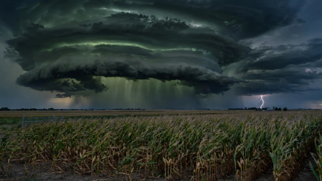
Severe Thunderstorms Warning: 5 Midwest States on Alert
A severe thunderstorms warning outlook is in effect for parts of five Midwest states today, as the National Weather Service warns that storms packing heavy rain, strong winds, large hail and frequent lightning could rattle Missouri, Illinois, Indiana, Ohio and Kentucky on Thursday, October 15, 2026. Forecasters say a powerful storm system sweeping across the Midwest and Great Lakes will bring an afternoon round of potentially severe weather to a corridor stretching from St. Louis through central Illinois and central Indiana toward Cleveland.
NOAA has placed that corridor under a Level 1 out of 5 risk of severe thunderstorms, according to the FOX Forecast Center, as moisture streams northward from the Gulf of Mexico ahead of an advancing cold front.
Which Areas Face the Severe Thunderstorms Warning Today
The five states under the National Weather Service alert are:
- Missouri — including the St. Louis area, where rain is expected to begin Thursday morning
- Illinois — central Illinois, including Chicago, with rain starting in the morning hours
- Indiana — central Indiana, including Indianapolis, where forecasters expect storms later in the day
- Ohio — including Cleveland, where storms are expected to hold off until the afternoon or early evening
- Kentucky — portions of the state in the path of the advancing storm system
The National Weather Service office in Indianapolis issued a Hazardous Weather Outlook at 5:21 a.m. Thursday covering much of central Indiana, expecting numerous showers and scattered thunderstorms during the day, with a few potentially becoming severe. Damaging winds and isolated flooding are the main concerns, according to the agency.
Cities such as Chicago, Milwaukee and St. Louis will see rain begin in the morning, while Detroit, Cleveland and Indianapolis are expected to see storms hold off until the afternoon or early evening, according to the FOX Forecast Center. Rainfall amounts are generally expected to remain under an inch in the main storm corridor, so forecasters say widespread flooding is not a major concern there.
What Threats Could the Storms Bring
The National Weather Service says Thursday’s storms could feature:
- Damaging winds — strong gusts capable of bringing down tree limbs and power lines
- Large hail — capable of damaging vehicles, roofs and crops
- Heavy rain — with isolated flash flooding possible in urban areas and near small streams
- Frequent lightning — produced by all thunderstorms and one of their most dangerous aspects
Severe Thunderstorm Watch vs. Warning: What Is the Difference?
As the storms develop, know the difference between the alerts the National Weather Service issues:
- Severe thunderstorm watch — issued when conditions are favorable for severe thunderstorms to develop. A watch means stay alert and be prepared to act. Watches typically cover large areas for several hours.
- Severe thunderstorm warning — issued when a severe thunderstorm has been spotted or indicated by weather radar in a specific area. A warning means the danger is happening now. Take shelter immediately when a warning is issued for your location.
A Hazardous Weather Outlook, like the one issued Thursday morning for central Indiana, identifies potential weather threats over the next seven days. It is not itself a warning — but it signals that residents should monitor forecasts and be ready if watches or warnings are issued.
What To Do During a Severe Thunderstorm Warning
The National Weather Service offers the following safety guidance:
- Stay weather ready. Keep listening to local news or a NOAA Weather Radio for updates on watches and warnings.
- At home: Go to an interior room on the lowest floor, away from windows. Take pets with you if time allows.
- At work or school: Stay away from windows and avoid large open rooms such as cafeterias, gymnasiums or auditoriums.
- Outside: Get inside a sturdy building immediately. Sheds are not safe, and sheltering under a tree can be deadly — it may fall on you and increases lightning risk.
- In a vehicle: A hard-topped vehicle is safer than being outside, but drive to the nearest secure shelter if time allows.
- When thunder roars, go indoors. Wait at least 30 minutes after the last thunder before going back outside.
Driving and Flooding Safety
Drivers should use caution on wet roads. The weather service warns that water can hide damage to the road underneath, and just 12 inches of rushing water can carry away most cars. Never drive around barriers or through flooded roadways. Residents with outdoor plans should be ready to move inside when thunder is heard, and secure loose outdoor items that strong winds could turn into projectiles.
Power Outage Preparedness
Strong winds are a leading cause of localized power outages. Before storms arrive, charge phones and portable battery packs, locate flashlights and extra batteries, and keep refrigerators closed during an outage to keep food safe. Report outages to your utility company and stay away from downed power lines.
Why October Can Bring Severe Weather
Severe thunderstorms are not limited to spring. In October, strong clashes between lingering warm, moist air from the Gulf of Mexico and increasingly powerful cold fronts pushing south from Canada create the ingredients for severe weather — instability, wind shear and a lifting mechanism. These autumn storm systems can be fast-moving, so conditions can change quickly and storms can arrive with less lead time.
Thursday’s setup follows that classic fall pattern: a surface low progressing northeastward toward the Great Lakes is pulling Gulf moisture northward, fueling showers and thunderstorms along and ahead of the cold front. As the front advances, the storm threat is expected to shift into the Northeast and Mid-Atlantic late Thursday into Friday.
What Comes After the Storms
Behind the cold front, conditions will turn sharply cooler and gusty. In central Indiana, forecasters expect wind gusts peaking at 25 to 35 mph on Friday, October 16. By Saturday night, October 17, widespread frost is possible across parts of the Midwest — an early signal of the season change that could damage sensitive outdoor plants. Gardeners may want to cover or bring in vulnerable plants ahead of the weekend.
Pingback: ALCS Game 3 Moved to 1pm ET: Rays-Guardians Rain Change - RadioSea